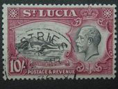
Castries (LC)
Castries (Hist: Carenager) is in a flood gut and is built on reclaimed land. It houses the seat of government and the head offices of many of foreign and local businesses. The city's design is in a grid pattern. Its sheltered harbour receives cargo vessels, ferry boats, and cruise ships. St Lucia's main post office is in Castries. Because most parts of the country do not use standard street addresses, mail is largely sent to P.O. boxes. Any mail sent without a town name ends up in the Castries post office.
Castries was founded by the French in 1650 as "Carénage" (meaning "safe anchorage") when St. Lucia was purchased by Jacques Dyel du Parquet, the governor of Martinique. It was renamed in 1756 after Charles Eugène Gabriel de La Croix, marquis de Castries, commander of a French expeditionary force to Corsica that year. The earlier settlement across the harbour at Vigie, started in 1651, was abandoned after a devastating hurricane in 1780. From 1803 to 1844, the British made the town a major naval port and built fortifications on Morne Fortune, the mountain that overlooks this important harbour. By 1844, Castries had a population of 4,000. By the end of the century it had become a major coaling station, because it was the only port in the Caribbean capable of accommodating the Royal Navy. During World War II, a German U-boat sailed into Castries harbor and sank two allied ships in 1942, including the Canadian ocean liner RMS Lady Nelson, which was subsequently refloated in the harbour and taken to Canada to be converted to a hospital ship. Castries has been rebuilt many times, following major fires in 1796 and 1813, and most notably on June 19, 1948.


