Loading map...
{"minzoom":false,"maxzoom":false,"mappingservice":"leaflet","width":"auto","height":"200px","centre":false,"title":"","label":"","icon":"","lines":[],"polygons":[],"circles":[],"rectangles":[],"copycoords":false,"static":false,"zoom":12,"defzoom":14,"layers":["OpenStreetMap"],"image layers":[],"overlays":[],"resizable":false,"fullscreen":false,"scrollwheelzoom":true,"cluster":false,"clustermaxzoom":20,"clusterzoomonclick":true,"clustermaxradius":80,"clusterspiderfy":true,"geojson":"","clicktarget":"","imageLayers":[],"locations":[{"text":"","title":"","link":"","lat":50.38,"lon":3.87,"icon":""}],"imageoverlays":null}
50.417, 3.833
Colfontaine (pronunciation: [kɔlfɔ̃tɛn]) is a municipality (20,762 inhabitans end 2017) created in 1977, located in the province of Hainaut, Belgium, on the French border. The municipality consists of the following sections: Pâturages, Warquignies, Wasmes (it includes Petit Wasmes).
Postal history before 1910
The PATURAGES post office opened on 17 November 1862. It used a Perception code 205 with bars (before 1864) and 290 with points before 1874. The WASMES post office opened on 15 January 1868. It used 382 with points.
A relay opened in 1900 at WARQUIGNIES.
Postmarks after 1950
Postal code: 7340
Baudouin period (1950-1993)
Postmarks before 1950
Leopold III period
Loading map...
{"minzoom":false,"maxzoom":false,"mappingservice":"leaflet","width":"auto","height":"200px","centre":false,"title":"","label":"","icon":"","lines":[],"polygons":[],"circles":[],"rectangles":[],"copycoords":false,"static":false,"zoom":13,"defzoom":14,"layers":["OpenStreetMap"],"image layers":[],"overlays":[],"resizable":false,"fullscreen":false,"scrollwheelzoom":true,"cluster":false,"clustermaxzoom":20,"clusterzoomonclick":true,"clustermaxradius":80,"clusterspiderfy":true,"geojson":"","clicktarget":"","imageLayers":[],"locations":[{"text":"","title":"","link":"","lat":50.417,"lon":3.833,"icon":""}],"imageoverlays":null}
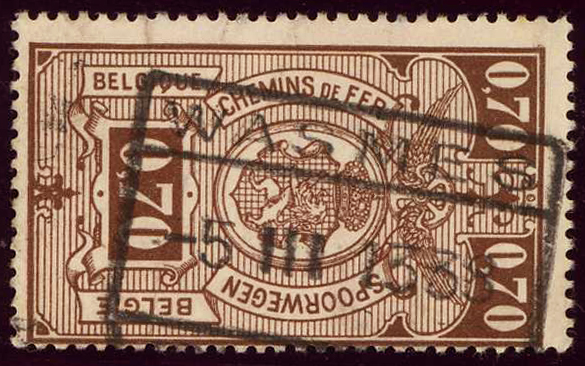 Railway at WASMES in 1938. |
|
Albert I period
Leopold II period
Covers
_a.jpg)
_LIII_a.jpg)

_b.jpg)
_BDN_a.jpg)
_BDN_b.jpg)
_LIII_b.jpg)
_ALBI_a.jpg)
_ALBI_b.jpg)
_LII_a.jpg)
_LII_b.jpg)
_Cover_a.jpg)