Loading map...
{"minzoom":false,"maxzoom":false,"mappingservice":"leaflet","width":"auto","height":"270px","centre":false,"title":"","label":"","icon":"","lines":[],"polygons":[],"circles":[],"rectangles":[],"copycoords":false,"static":false,"zoom":12,"defzoom":14,"layers":["OpenStreetMap"],"image layers":[],"overlays":[],"resizable":false,"fullscreen":false,"scrollwheelzoom":true,"cluster":false,"clustermaxzoom":20,"clusterzoomonclick":true,"clustermaxradius":80,"clusterspiderfy":true,"geojson":"","clicktarget":"","imageLayers":[],"locations":[{"text":"","title":"","link":"","lat":39.759444,"lon":-84.191667978781,"icon":""}],"imageoverlays":null}
Dayton is the sixth-largest city in the state of Ohio and the county seat of Montgomery County. A small part of the city extends into Greene County. The 2018 U.S. census estimate put the city population at 140,640, while Greater Dayton was estimated to be at 803,416 residents. This makes Dayton the fourth-largest metropolitan area in Ohio and 63rd in the United States. Dayton is within Ohio's Miami Valley region, just north of Greater Cincinnati.
Read more @ https://en.wikipedia.org/wiki/Dayton,_Ohio
Postmark Examples
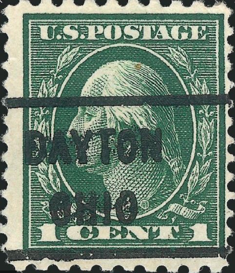 Precancel Dayton on Scott 405, Washington. c.1912. |
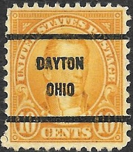
 Precancel Dayton on Scott 551, Hale. c.1925. |
 Precancel Dayton on Scott 684, Harding. c.1930. |
 Precancel Dayton on Scott 558, Garfield. c.1922. |
 Precancel Dayton on Scott 561, Jefferson. c.1923. |
 Precancel Dayton on Scott 624, Monroe. c.1927. |
Commemorative Postmarks
 22nd Airpex Station commemorating the 53rd anniversary of Glenn Miller's disappearance over the english channel Dec 15, 1944, Dayton 4 Oct 1997 |
|
Meter cancels
Cards and Covers
 Dayton 1938. First day of Use Airmail Stamp C23, Eagle Holding Shield, 6c |
 Dayton 1963. First day of Use luminescent Tagging |
|-
 Dayton 1963. First day of Use luminescent Tagging |
 Dayton 1963. First day of Use luminescent Tagging |

_1912.jpg)
_1925.jpg)
_1930.jpg)
_1922.jpg)
_1923.jpg)
_1927.jpg)
_comm01.jpg)
_mc3.jpg)
_mc1.jpg)
_mc2.jpg)
_CC2.jpg)
_CC1.jpg)


_comm02.jpg)