Loading map...
{"minzoom":false,"maxzoom":false,"mappingservice":"leaflet","width":"auto","height":"200px","centre":false,"title":"","label":"","icon":"","lines":[],"polygons":[],"circles":[],"rectangles":[],"copycoords":false,"static":false,"zoom":10,"defzoom":14,"layers":["OpenStreetMap"],"image layers":[],"overlays":[],"resizable":false,"fullscreen":false,"scrollwheelzoom":true,"cluster":false,"clustermaxzoom":20,"clusterzoomonclick":true,"clustermaxradius":80,"clusterspiderfy":true,"geojson":"","clicktarget":"","imageLayers":[],"locations":[{"text":"","title":"","link":"","lat":-4.36,"lon":15.32,"icon":""}],"imageoverlays":null}
Kinshasa (formerly Leopoldville (French: Léopoldville or Dutch: Leopoldstad) is the capital and the largest city of the Democratic Republic of the Congo. It is located on the Congo River.
Once a site of fishing villages, Kinshasa is now an urban area with a 2014 population of over 11 million. It faces the capital of the neighbouring Republic of Congo, Brazzaville, which can be seen in the distance across the wide Congo River.
Kinshasa is the third largest urban area in Africa after Cairo and Lagos.
Read more @ https://en.wikipedia.org/wiki/Kinshasa
Kinshasa
See the page Kinshasa (ZR).
Republic
 Cancel Leopoldville/Leopoldstad 1 (6-II-1965) on postage stamp "National Palace", an emission of 1964. The StampSet is shown here:  |
 Circle on the Anniversary 1965 issue. |
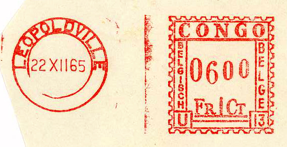 Red meter end 1965 CONGO BELGE! |
Belgian Congo period 1909-1960
|
|
 Circle LEOPOLDVILLE 1-0 in 1948. |
 Bilingual LEOPOLDVILLE C on a 1952 issue. |
 Bilingual LEOPOLDVILLE-STAD LUCHTHAVEN-AEROGARE (Airport) in 1953. |
|
|
|
 Bilingual LEOPOLDVILLE-STAD 1 in 1957. |
Limete
Cover
 Arrival postmark in 1921! |
Congo Independent State 1886-1909
_a.jpg)
_RDC_b.jpg)
_RDC_a.jpg)
_BCO_a.jpg)
_BCO_1948.jpg)
_BCO_1952.jpg)
_BCO_1953.jpg)


_BCO_1957.jpg)
_Limete_BCO_a.jpg)
_BCO_cover_a.jpg)
_CIS_b.jpg)
_CIS_a.jpg)