Loading map...
{"minzoom":false,"maxzoom":false,"mappingservice":"leaflet","width":"auto","height":"250px","centre":false,"title":"","label":"","icon":"","lines":[],"polygons":[],"circles":[],"rectangles":[],"copycoords":false,"static":false,"zoom":11,"defzoom":14,"layers":["OpenStreetMap"],"image layers":[],"overlays":[],"resizable":false,"fullscreen":false,"scrollwheelzoom":true,"cluster":false,"clustermaxzoom":20,"clusterzoomonclick":true,"clustermaxradius":80,"clusterspiderfy":true,"geojson":"","clicktarget":"","imageLayers":[],"locations":[{"text":"","title":"","link":"","lat":50.484,"lon":4.536,"icon":""}],"imageoverlays":null}
Fleurus (Walloon: Fleuru) is a Walloon municipality located in the Belgian province of Hainaut.
It has been the site of 4 major battles.
Fleurus has seven villages: - Postal code:
- 6222 Brye (wa: Briye)
- 6220 Heppignies (wa: Epniye)
- 6220 Lambusart (wa: Lambussåt)
- 6221 Saint-Amand (wa: Sint-Amand)
- 6223 Wagnelée (wa: Wagnlêye)
- 6224 Wanfercée-Baulet (wa: Wanfercêye-Bålet)
- 6220 Wangenies (wa: Wanjniye)
Postal history
The FLEURUS post office opened in 1835. It used a postal code 39 with bars (before 1864), and 128 with points before 1874.
The WAGNELEE-CHASSART opened in 1882.
The WANFERCEE-BAULET opened in 1889 (after a relay in 1880).
The LAMBUSART post office opened in 1905.
Postmarks after 1950
Meter cancels
 Meter cancel Fleurus 1990 |
Baudouin period
Postmarks before 1950
Leopold III period
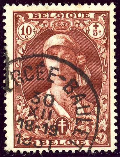
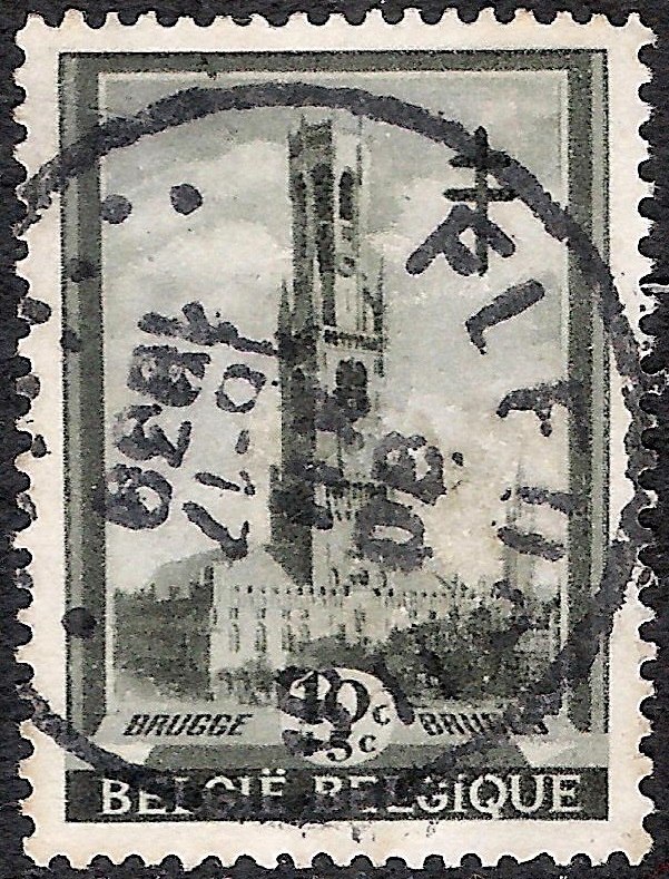 Fleurus, 30-XII-1939 on Stamp Brugge from series Befries 1939:  |
Albert I period
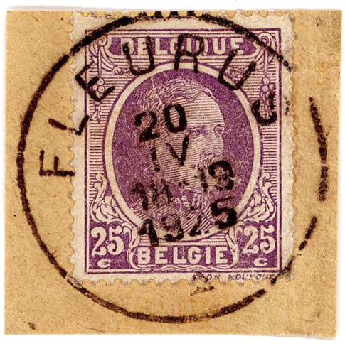 Circle FLEURUS in April 1925. Expedition 18-19 h. |
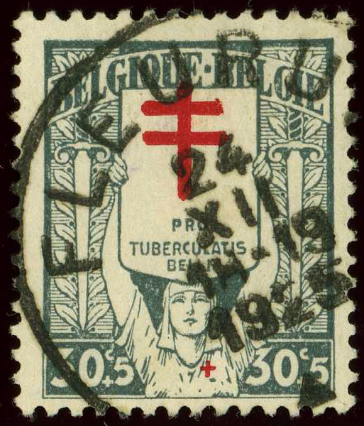 Circle FLEURUS in December 1925. Expedition 18-19 h. |
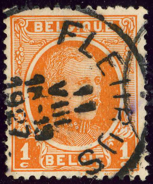 Circle FLEURUS in 1927. Expedition 18-19 h. |
WANFERCEE-BAULET
 Circle WANFERCḖE-BAULET in 1931, Queen Elisabeth. |
Leopold II period
Railway - Postal Parcels (Leopold II period)
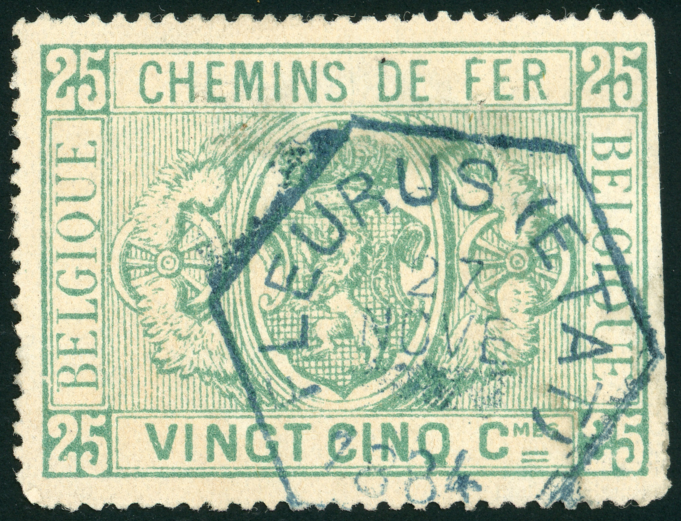 FLEURUS (ETAT) Railway Hexagonal Cancel in 1884. |
|
Covers
_mc1.jpg)
_a.jpg)
_ALBI_a.jpg)
_ALBI_b.jpg)
_ALBI_1927.jpg)
_Wanferc%C3%A9e-Baulet_ALBI_a.jpg)
_LII_RPP_a.jpg)
_aa.jpg)
_b.jpg)
_BDN_a.jpg)
_BDN_b.jpg)
_LIII_a.jpg)
_LIII_b.jpg)
_LII_a.jpg)
_LII_b.jpg)
_LII_RPP_b.jpg)
_Cover_a.jpg)