Loading map...
{"minzoom":false,"maxzoom":false,"mappingservice":"leaflet","width":"auto","height":"200px","centre":false,"title":"","label":"","icon":"","lines":[],"polygons":[],"circles":[],"rectangles":[],"copycoords":false,"static":false,"zoom":12,"defzoom":14,"layers":["OpenStreetMap"],"image layers":[],"overlays":[],"resizable":false,"fullscreen":false,"scrollwheelzoom":true,"cluster":false,"clustermaxzoom":20,"clusterzoomonclick":true,"clustermaxradius":80,"clusterspiderfy":true,"geojson":"","clicktarget":"","imageLayers":[],"locations":[{"text":"","title":"","link":"","lat":11.924382,"lon":79.813677,"icon":""}],"imageoverlays":null}
Pondicherry is a city, an urban agglomeration and a municipality in Pondicherry district in the Indian union territory of Puducherry. It is affectionately known as Pondy, and has been officially known by the alternative name Puducherry since 2006.
The City of Pondicherry have recorded history after the advent of the Colonial Powers like the Dutch, Portuguese, English and the French. The French acquired Puducherry in 1674 and held control, with occasional interruption from the British and Dutch, until 1954 (de jure in 1956), when it was incorporated into the Indian Union along with the rest of French India.
Postmark Examples
 Telegraphic cancellation, British India Used Abroad as Pondicherry was French India |
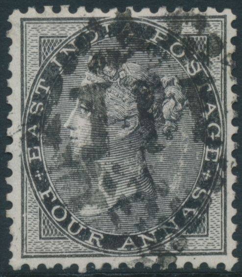
 British India used in Pondicherry (Numeral cancel 111) which was French India |
 British India used in Pondicherry (Numeral cancel 111) which was French India |
 Exhibit of Pondicherry Cancels
_image_a.jpg)
_image_b.jpg)
_image_c.jpg)